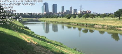
The Domain at The Bluffs is a 353-unit multi-family complex, built on 10.8 acres and anchored by the historic Garvey House. The project site was a mixture of existing residences and vacant lots located along Samuels Avenue and the historic Trinity River Bluff, a Traditional Cultural Property (TCP), in north Fort Worth, Texas.
Design and permitting of the project required extensive coordination with the U.S. Army Corps of Engineers (USACE), Texas Historical Commission (THC), City of Fort Worth, and the Trinity River Water District (TRWD). Because portions of the project were to be constructed below the USACE Fort Worth District federal project boundary, a Section 408 Permission was required for the Domain at The Bluffs development.
VRX assisted in preparing a Section 408 Permission inclusive of a Supplemental Environmental Assessment (SEA) that was tiered to the Programmatic Environmental Assessment (PEA) titled, Civil Works Minor Section 408 NEPA Compliance, United States Army Corps of Engineers (USACE), Fort Worth District, dated April 11, 2011.
The SEA included assessing impacts to:
• Socioeconomic Resources
• Hazardous Materials
• Noise and Aesthetics
• Aquatic Resources including Surface Water, Groundwater, and Water and Wetland of the U.S.
• Biological Resources including Vegetation, Fish and Wildlife, and Threatened and Endangered Species
• Air Quality
• Climate
• Cultural Resources including Historic and Archeological Resources
• Recreation
The Section 408 Permission process involved extensive coordination with USACE Environmental personnel to address impacts to riparian woodlands, historic structures including preservation of the Garvey House and the Trinity River Bluff, as well as threatened and endangered species. The Section 408 Permission received approval from the USACE and TRWD in April 2017.
VRX delineated waters of the U.S., assessing proposed impacts to waters of the U.S. associated with constructing a storm sewer outfall in the West Fork Trinity River. We permitted the impact through Regional General Permit 12 and coordinated with the USACE to attain timely authorization. Delineations included defining the limits of the West Fork Trinity River, the ordinary high-water mark, and characterizing the adjacent vegetation communities. USACE jurisdiction limits were mapped using sub-meter-accuracy GPS data and incorporated into a geographic information system so the footprint and volume of fill within waters of the U.S. could be determined.
Additionally, VRX evaluated and documented the existing tree and vegetation communities and to determine anticipated impacts. Nearly 660 trees, were surveyed and tagged at the project site. This information was used to develop an Urban Forestry Plan in accordance with City of Fort Worth Urban Forestry Ordinances.

